
")
Gilbert Rossi, Parc National du Mercantour
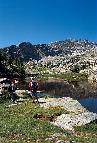
The Maritime Alps are a paradise for hikers. Almost all the summits, even the highest ones (over 3100m, 11500ft) can be reached simply by walking, with no climbing and without the hands. You will see eagles, chamois, marmots. You're unlikety to see the wolfes, though.
But there is not only the high moutains to discover here. From the trails along the sea to the walks around the inland villages, a large variety of possibilities exists.
You can download for free the Departemental Council guide-books giving hints and information about them. They're in French but with maps and pictures.
Or you can use this 3D site of the same Council to choose your next hiking.
Weather
Let's start with this advice: in the Mountains, it is very important to take into account the weather. Thunderstorms can develop very quickly and fog can change so much the landscape as to confuse you and get you lost. Check the weather forecast before leaving. Don't use the coast forceast since the weather can be very different. Check the forecast the day when you hike, not several days before. Also remember that the forecasts in the mountains are not as reliable as elsewhere. If you see a storm building up, believe what you see, not what the forecast said.
You can get the local forecast using Meteo France , the official agency and selecting the name of the city where you'll be hiking, for exemple Belvédère or St Etienne de Tinée in the drop down menu. The drawback is that this site is so overloaded with advertising such as videos...
Beware. Even in summer there is snow high in the mountains. Sometimes it's only small areas, but it's dangerous all the same (see below).
Maps
Nothing compares with a chart and you must have one to hike in the mountains. If the weather changes and you get lost, your map will be your only way home.
There isn't much choice. You will use the maps produced by the IGN, the French Geographical Institute, a public institution. The scale is 1/25000, meaning that one cemtimeter on the paper represents 250m in reality. Therefore they have all the details you will need. They cost around 12€ per chart and there are 16 of them for the whole Maritime Alps. Of course you don't need them all.
It is a good idea, too, to have an other map (1/100000 or 1/75000). It will enable you to identify the mountains you will see from the summit and which are too far to be on your 1/25000 map. The 1/75000 is more precise but it depicts only the Northern half of the Maritim Alps, unlike the 1/100000 which covers the whole area in one chart. (But a little part, North of St Etienne de Tinée.)
You can order right now your charts.
Hiking for the rookies
If you have never hiked in high mountains in summer, here are a few advices for beginners.
First : check the weather. (See above).
Trails are shown by yellow lines painted on rocks or trees. The GR, or Grande Randonnée trails (great hiking) are shown with red and white markers.
You will also see piles of stones, called "cairns' (say kern) along the trails. You can add your own stone. When the weather is nice you may wonder why they're there. But if it turns foggy...
Neither these marks nor the wooden signs along the trails can be a substitute to a map. That's the opposite: the map will show you exactly where the wooden sign in front of you is, thanks to its number.
In the mountains it can be quickly cold if a cloud hides the sun. Take a windbreaker and a sweater. Bring much water, altitude dehydrates. Bring food too, of course.
To cross a snow patch is hazardous, even if it's only 4 meters wide. The risk is to glide on the snow and, with the speed, to break oneself on the rocks under it. It kills. Be cautious and walk slowly on the snow.
If you take children along, choose a short enough hike. It's better to stop before they are exhausted. Remember that going down is almost as tiring as climbing, but not for the same reasons. Your muscles will have to work in an unusual manner to slow you down and it will hurt everywhere even the next day if you're not used to it.
In the next pages a few ideas.
- Prev
- Next >>